
Professional Drone Loss Adjuster Inspection: Precision Data for UK Insurance Claims
- John Palmer (Director, DTA)

- Jun 9
- 12 min read
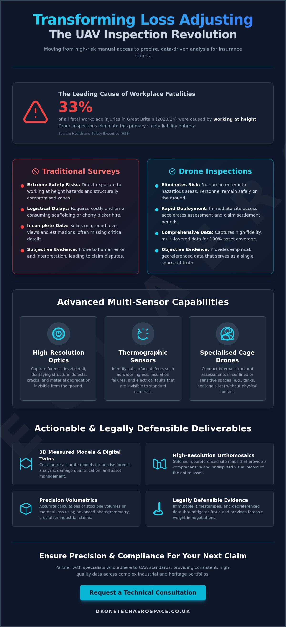
Working at height remained the leading cause of workplace fatalities in Great Britain throughout 2023/24, representing 33% of all fatal injuries according to the Health and Safety Executive. For those conducting a drone loss adjuster inspection on complex industrial or heritage assets, this technology eliminates the primary safety liabilities and logistical delays associated with scaffolding or manual roof access. You're likely aware that traditional ground-based surveys often fail to capture the granular detail required for high-stakes forensic analysis, particularly when dealing with inaccessible structural elements or sprawling sites.
This article demonstrates how advanced UAV technical inspections provide the high-accuracy, legally defensible data required to transform the claims process into a precise technical exercise. You'll discover how specialised platforms (utilising thermographic sensors and high-resolution optics) deliver the exhaustive evidence needed to satisfy rigorous underwriting and legal standards. We'll examine the integration of multi-sensor data into industrial BIM workflows and the impact of the 2026 UK drone regulations on professional evidence gathering. This methodical approach ensures that even the most complex claims are settled with absolute precision and professional accountability.
Key Takeaways
Transition from high-risk manual surveys to data-driven UAV inspections to eliminate workplace safety liabilities whilst significantly accelerating claim settlement periods.
Utilise multi-sensor payloads, including thermographic and fugitive methane gas sensors, to identify subsurface defects and environmental hazards that remain invisible to standard photography.
Deploy specialised ball/cage-drone technology to conduct internal structural assessments in confined spaces or sensitive heritage environments without the requirement for physical contact or scaffolding.
Secure legally defensible evidence through a professional drone loss adjuster inspection, providing high-resolution orthomosaics and 3D measured building models for precise forensic analysis.
Ensure full regulatory compliance and operational consistency by partnering with specialists who adhere to current CAA standards across complex, multi-site industrial portfolios.
Table of Contents
The Evolution of Insurance Loss Adjusting via UAV Technology
Technical Capabilities for High-Stakes Insurance Risk Assessments
From Confined Spaces to Heritage Sites: Specialist Claim Applications
Actionable Deliverables: Data Accuracy and Legally Defensible Evidence
Partnering with Drone Tech Aerospace for National UK Coverage
The Evolution of Insurance Loss Adjusting via UAV Technology
The insurance industry is undergoing a fundamental shift in how physical risk and damage are quantified. Traditionally, loss adjusters relied on ground-level observations or limited rooftop access, often resulting in anecdotal or incomplete evidence. The integration of The Evolution of Insurance Loss Adjusting via UAV Technology has transformed this process from reactive photography into a proactive, data-driven discipline. A professional drone loss adjuster inspection provides high-fidelity, multi-layered data that serves as a single source of truth for all stakeholders involved in a claim.
Safety remains the primary driver for this transition. According to the Health and Safety Executive (HSE), working at height was the leading cause of workplace fatalities in Great Britain in 2023/24, accounting for 33% of all fatal injuries. By deploying unmanned systems, insurers eliminate the need for personnel to enter structurally compromised or hazardous zones. This shift doesn't just protect lives; it also streamlines the claim lifecycle. Professional-grade aerial data allows for immediate site assessment, reducing the reliance on lengthy manual surveys and accelerating the settlement process for policyholders.
Overcoming the Limitations of Traditional Site Access
Scaffolding and cherry pickers are often prohibitively expensive and logistically complex, especially amongst industrial ruins or heritage sites where ground stability is uncertain. Professional UAV deployments allow for immediate access to these environments without the lengthy lead times associated with heavy equipment hire. This capability minimises operational downtime for the policyholder whilst ensuring that the loss adjuster can inspect hazardous or inaccessible areas (such as high-voltage infrastructure or unstable roof sections) with absolute precision. Unlike standard photography, these technical inspections use specialised flight paths to ensure 100% coverage of the asset.
The Impact of High-Resolution Evidence on Claim Accuracy
Human error is a significant factor in manual surveys, where measurements are often estimated or key areas are overlooked due to physical constraints. Industrial-grade drone loss adjuster inspection workflows eliminate these variables by providing a comprehensive, timestamped, and georeferenced visual record. This level of detail distinguishes a professional-grade technical inspection from basic aerial photography, providing the forensic weight required for complex industrial and commercial claims.
Precision Volumetrics: Accurate calculations of material loss or stockpile volumes using photogrammetry.
Forensic Detail: High-resolution sensors capture structural defects invisible to the naked eye from the ground.
Fraud Mitigation: Immutable metadata and georeferenced imagery ensure the integrity of the evidence presented in multi-party negotiations.
By providing a transparent and exhaustive visual record, UAV technology reduces the friction in multi-party negotiations and ensures that settlement figures are based on empirical data rather than subjective interpretation.
Technical Capabilities for High-Stakes Insurance Risk Assessments
Professional risk assessment in the industrial and commercial sectors requires a transition from qualitative visual observations to quantitative technical data. A modern drone loss adjuster inspection utilizes multi-sensor payloads (combining high-resolution RGB optics with thermographic and gas-sensing capabilities) to provide an exhaustive profile of asset integrity. This multi-layered approach ensures that hidden defects, which frequently lead to catastrophic failure or significant insurance liabilities, are identified with absolute precision before they escalate.
The collection of topographical data and centimetre-accurate 2D orthomosaic maps is fundamental for land-based claims and subsidence monitoring. By employing advanced photogrammetry, surveyors can generate georeferenced models that allow for precise volumetric analysis of stockpiles or material loss following environmental incidents. This level of accuracy is essential for meeting the standards required for Actionable Deliverables: Data Accuracy and Legally Defensible Evidence, ensuring that all findings are compliant with UK Civil Aviation Authority (CAA) frameworks and suitable for judicial review.
Thermographic Analysis for Electrical and Structural Defect Detection
Thermal imaging allows loss adjusters to identify heat signatures that indicate failing electrical components, such as overheating transformers or potential arc flash hazards, without requiring a site shutdown. In structural applications, thermography detects moisture entrapment and insulation gaps within flat roof systems or composite cladding. These non-destructive testing (NDT) methods provide a clear evidence base for insurance risk profiling, capturing critical data in various light and environmental conditions to ensure a comprehensive assessment of the building envelope.
Specialised Gas Sensing for Industrial Compliance Claims
For the petrochemical and renewable energy sectors, identifying fugitive methane leaks is a critical component of environmental liability assessment. Specialised UAV sensors detect gas concentrations that are invisible to the naked eye, allowing for the precise localisation of leaks across vast pipeline networks or industrial plants. Quantifying these emissions supports insurance claims related to environmental damage and operational loss, providing a factual basis for multi-party negotiations and regulatory compliance reporting.
Integrating these high-precision data sets into a broader industrial drone inspection strategy facilitates long-term asset management and predictive maintenance. This methodical approach allows corporate clients to move beyond reactive claim filing toward a robust risk mitigation framework. For organisations requiring this level of technical rigour, our specialised drone inspection services provide the reliability and professional accountability necessary for large-scale industrial requirements.
From Confined Spaces to Heritage Sites: Specialist Claim Applications
Standard aerial surveys typically focus on external building envelopes and roof structures. However, complex industrial and heritage insurance claims frequently involve internal voids or sensitive environments where standard UAVs cannot operate safely. A specialised drone loss adjuster inspection utilizes collision-tolerant systems to navigate GPS-denied areas with absolute precision. These platforms operate within industrial tanks, chimneys, and internal structural voids, providing high-resolution visual evidence without the safety risks associated with human entry into confined spaces. This methodical approach ensures that even the most inaccessible structural defects are documented with forensic rigour, providing a level of detail that traditional ground-based methods simply cannot match.
Internal and Confined Space Inspections via Cage Drones
The deployment of ball/cage-drone technology is essential for assessing internal structural elements that are inaccessible via traditional means. These systems are enclosed in a protective carbon-fibre frame (allowing them to remain stable even after contact with obstructions). This capability is critical for inspecting internal ceilings, high-level gantry cranes, or the interior of industrial boilers. By eliminating the requirement for confined space entry (CSE), organisations significantly reduce the logistical burden of safety permits and standby rescue teams. Research indicates that drone inspections can lead to an average cost reduction of 70% compared to traditional methods like scaffolding. High-intensity onboard lighting systems ensure that even in pitch-black environments, the visual data remains clear and suitable for legal evidence.
Preserving Heritage Integrity during Loss Adjustment
Heritage assets (particularly Grade I and II listed buildings) require a non-invasive approach to damage assessment. Traditional inspection methods, such as erecting scaffolding against fragile stonework, carry an inherent risk of secondary damage. Professional UAV surveys allow for the identification of subtle stone decay, lead theft, or roof failures amongst intricate architecture without any physical contact with the structure. The resulting data is used to create centimetre-accurate 3D models, which are indispensable for historical restoration planning following a loss. These models provide a comprehensive baseline for insurers to quantify repair costs whilst ensuring that the historical fabric of the building remains undisturbed. This high-detail documentation is vital for multi-party negotiations involving conservation officers and specialist contractors.
The ability to navigate complex internal geometries and sensitive historical sites distinguishes professional-grade operations from standard aerial services. By integrating advanced flight algorithms with specialised hardware, a drone loss adjuster inspection provides a level of security and assurance that is vital for high-stakes insurance requirements. This technical prowess ensures that every aspect of a claim is supported by empirical, high-resolution data.
Actionable Deliverables: Data Accuracy and Legally Defensible Evidence
Professional evidence must withstand the rigours of judicial review and multi-party scrutiny. A standard drone loss adjuster inspection is distinguished by its geodetic accuracy, achieved through the strategic deployment of Ground Control Points (GCPs) and RTK (Real-Time Kinematic) positioning. These methods anchor aerial data to precise global coordinates. This ensures that every measurement is centimetre-accurate and legally defensible. This level of technical rigour is essential for industrial claims where boundary disputes or large-scale structural deformations are at issue.
3D Modelling and Digital Twins for Loss Analysis
Digital twins provide a three-dimensional, interactive record of an asset's condition at a specific point in time. By comparing time-series 3D data, adjusters can visualise structural shifts or subsidence with absolute clarity. These models allow for precise volumetric analysis. This enables the exact calculation of material loss or debris volume following a catastrophic event. Data is delivered in industry-standard formats, such as .las, .obj, or .xyz, for seamless integration into BIM (Building Information Modelling) and CAD workflows used by civil engineers and architects.
Orthomosaic Mapping for Large-Scale Property Claims
An orthomosaic is a geometrically corrected map stitched from thousands of individual high-resolution images. It provides a uniform scale across hectares of terrain. Adjusters can zoom from a site-wide overview down to millimetre-level detail. This capability is vital for verifying land damage or identifying subtle patterns of defect across vast industrial complexes. Because the map is georeferenced, it serves as an immutable record for multi-party negotiations and insurance risk assessments. It eliminates the ambiguity often found in traditional handheld photography.
The integration of these deliverables into existing professional workflows ensures that all stakeholders have access to the same high-fidelity data set. This transparency reduces friction during the claim settlement process. For insurance professionals requiring this level of technical rigour, our drone insurance risk assessment and loss adjuster inspections provide the exhaustive evidence required for complex, high-stakes claims.
Partnering with Drone Tech Aerospace for National UK Coverage
Scaling technical inspections across national property portfolios requires a partner with established industrial authority and a proven track record in high-stakes environments. Drone Tech Aerospace operates as a high-capacity provider, delivering consistent data quality and professional accountability across the UK. Our operations are structured to handle the complexities of large-scale industrial and heritage claims, providing loss adjusters with a single point of contact for exhaustive evidence gathering. By maintaining a methodical approach to every drone loss adjuster inspection, we ensure that the resulting data sets are technically robust and suitable for multi-party negotiations.
Professional Accountability and CAA Certification
Adherence to Civil Aviation Authority (CAA) regulations is the foundation of insurance-compliant data gathering. Professional pilots operating in the "Specific" category must hold a valid Operational Authorisation, typically supported by a General Visual Line of Sight Certificate (GVC). This certification is essential for managing complex flight permissions in congested urban centres or high-risk industrial plants. Compliance also extends to the latest 2026 hardware standards. Drones sold in the UK must now carry UK class marks (UK0 to UK6), and professional-grade units are required to broadcast Remote ID data during flight operations. Our teams manage these regulatory requirements internally, ensuring that all aerial operations are fully risk-assessed and covered by commercial liability insurance that complies with EC 785/2004 regulations.
The Drone Tech Aerospace Advantage for Loss Adjusters
Leveraging over a decade of experience in technical aerial surveying, we provide a sophisticated specialist service that moves beyond standard photography. Our expertise spans diverse sectors, including construction site monitoring, solar-farm drone inspections, and wind turbine drone inspections. This breadth of capability allows us to deliver bespoke reporting tailored to the specific technical requirements of a claim. Whether quantifying material loss on a renewable energy site or assessing structural failure in a heritage asset, our data is delivered with the precision required for forensic analysis.
National Reach: Consistent service delivery across all UK regions for multi-site commercial portfolios.
Industrial Expertise: Proven methodologies for fugitive methane gas surveys and internal confined space inspections.
Bespoke Deliverables: Data provided in formats compatible with existing BIM and CAD infrastructure.
Operational Scale: The capacity to handle large-scale requirements that smaller, less specialised providers cannot support.
In the demanding field of insurance loss adjustment, the reliability of evidence is paramount. Drone Tech Aerospace functions as a high-performance partner, providing the technical prowess and professional gravity necessary to support complex claims. Our commitment to accuracy and regulatory compliance ensures that every drone loss adjuster inspection provides a secure foundation for risk assessment and claim settlement.
Advancing Industrial Insurance Standards with High-Precision UAV Data
The transition toward multi-sensor, georeferenced evidence is now essential for complex industrial and heritage claims. By integrating thermographic analysis, fugitive gas detection, and centimetre-accurate 3D modelling, insurers can resolve multi-party disputes with absolute technical certainty. A professional drone loss adjuster inspection provides the forensic weight necessary to satisfy rigorous legal and underwriting standards whilst eliminating the safety liabilities of working at height. This methodical approach ensures that settlement figures are based on empirical data rather than subjective ground-level observations.
Drone Tech Aerospace provides the operational scale and technical prowess required for large-scale national portfolios. With over a decade of industrial inspection experience and a team of CAA-certified pilots, we deliver consistent, high-fidelity results across the UK. Our commitment to regulatory compliance and geodetic accuracy ensures that your data remains legally defensible in any professional context. Enquire about professional drone loss adjuster inspections to secure precise, high-accuracy data for your next complex claim. We look forward to supporting your technical evidence requirements with professional accountability and industry-leading expertise.
Frequently Asked Questions
How does a drone loss adjuster inspection improve claim accuracy?
A professional drone loss adjuster inspection improves accuracy by delivering georeferenced, high-fidelity data that serves as a single source of truth. Unlike manual surveys that rely on anecdotal evidence or limited roof access, UAV technology captures exhaustive visual and thermal profiles. This precision allows for the exact quantification of structural defects or material loss. It ensures that settlement figures are based on empirical evidence rather than subjective estimates.
Are drone inspections for insurance claims legal in the UK?
Drone inspections are entirely legal in the UK when conducted by operators who adhere to Civil Aviation Authority (CAA) frameworks. Commercial pilots must hold a valid Operational Authorisation and maintain liability insurance compliant with EC 785/2004 regulations. From 2026, drones must also carry UK class marks and broadcast Remote ID data. Using a certified provider ensures that all data gathered is legally defensible and compliant with current aviation law.
Can drones be used for internal insurance inspections of confined spaces?
Specialised collision-tolerant drones, often referred to as ball or cage drones, are designed specifically for internal and confined space inspections. These systems operate in GPS-denied environments such as industrial tanks, chimneys, and internal structural voids. They provide high-resolution visual evidence without requiring personnel to enter hazardous zones. This capability reduces the logistical burden of safety permits whilst capturing detail in areas that remain inaccessible to traditional survey methods.
What kind of data deliverables should a loss adjuster expect from a drone survey?
Loss adjusters should expect a comprehensive suite of technical deliverables, including centimetre-accurate 3D measured building models and high-resolution orthomosaic maps. These outputs are typically provided in industry-standard formats like .las or .obj for seamless integration into BIM and CAD workflows. Additional data sets may include thermographic maps for identifying moisture ingress and specialised gas sensing reports for environmental liability assessments. Every deliverable is georeferenced to ensure geodetic accuracy.
How long does a typical drone insurance inspection take on-site?
On-site duration varies depending on the scale and complexity of the asset, though most standard industrial or heritage inspections are completed within a few hours. This is significantly faster than traditional methods that require the erection of scaffolding or the deployment of cherry pickers. Rapid data acquisition allows for minimal operational downtime for the policyholder. The efficiency of the flight process ensures that adjusters receive actionable evidence far sooner than through manual survey techniques.
Is drone data admissible as evidence in UK insurance disputes?
High-precision aerial data is fully admissible as evidence in UK insurance disputes and judicial reviews. To maintain its legally defensible status, the data from a drone loss adjuster inspection must be captured by CAA-certified pilots and anchored to precise coordinates using Ground Control Points (GCPs). This geodetic accuracy prevents the manipulation of evidence and ensures that measurements are verifiable. Immutable metadata and timestamped imagery provide a transparent audit trail that withstands scrutiny from multi-party legal teams.
What are the cost benefits of using drones over traditional scaffolding?
Utilising UAVs can lead to an average cost reduction of 70% compared to traditional scaffolding or platform access. These savings are achieved by eliminating expensive equipment hire, reducing the number of personnel required on-site, and significantly shortening the survey timeline. Beyond direct financial savings, drones mitigate the financial risks associated with workplace accidents. They provide a more cost-effective method for gathering exhaustive data on large-scale or structurally compromised industrial sites.
Can drones detect hidden water damage or gas leaks for insurance purposes?
Advanced UAVs equipped with thermographic sensors can identify heat signatures indicative of moisture entrapment or insulation failures within a building envelope. This non-destructive testing method reveals hidden water damage that is invisible to the naked eye. Similarly, specialised sensors can conduct fugitive methane gas surveys to detect and quantify leaks in industrial plants or pipelines. These technical capabilities provide loss adjusters with the quantitative data necessary to assess complex environmental and structural liabilities.


Comments