
Professional Residential Roof Drone Survey: A Comprehensive Guide for 2026
- John Palmer (Director, DTA)

- 1 day ago
- 12 min read
Forcing a surveyor to scale a ladder and traverse fragile roof tiles is no longer a standard procedure; it's a liability. Most property owners recognise the inherent frustration of paying significant sums for scaffolding just to identify a minor leak, whilst simultaneously worrying that the weight of the inspector might cause further structural damage. A professional residential roof drone survey eliminates these risks by utilising high-specification UAV technology to capture precision data without a single foot touching the roof surface.
You're likely seeking a solution that balances technical accuracy with operational safety and cost-efficiency. This comprehensive guide demonstrates how advanced aerial inspections provide a safer, faster, and more accurate alternative to traditional manual methods, delivering actionable, high-resolution results that meet the rigorous standards of modern surveyors. We'll examine the specific technical advantages of drone-led audits (including orthomosaic mapping), the precision of thermographic analysis for detecting moisture ingress, and why this method is now the preferred standard for insurance and maintenance planning in 2026.
Key Takeaways
Understand how advanced UAV systems eliminate the inherent safety hazards and structural risks associated with traditional manual roof inspections.
Learn about the integration of thermographic sensors and sub-centimetre resolution imaging to identify hidden moisture ingress and thermal inefficiencies.
Discover the significant operational cost and time savings achieved by utilising a residential roof drone survey instead of expensive scaffolding installations.
Identify the essential components of a professional survey report, including georeferenced imagery and comprehensive defect annotations for insurance compliance.
Gain insights into selecting a high-capacity partner that delivers industrial-grade precision for residential property portfolios and complex structural audits.
Table of Contents
Beyond the Ladder: The Evolution of Residential Roof Surveys
Technical Capabilities: High-Resolution Imaging, Thermal Analysis, and 3D Modelling
Comparative Analysis: Drone Surveys vs. Traditional Scaffolding
Evaluating Survey Outputs: What a Professional Report Should Include
Selecting a Professional Partner: The Drone Tech Aerospace Advantage
Beyond the Ladder: The Evolution of Residential Roof Surveys
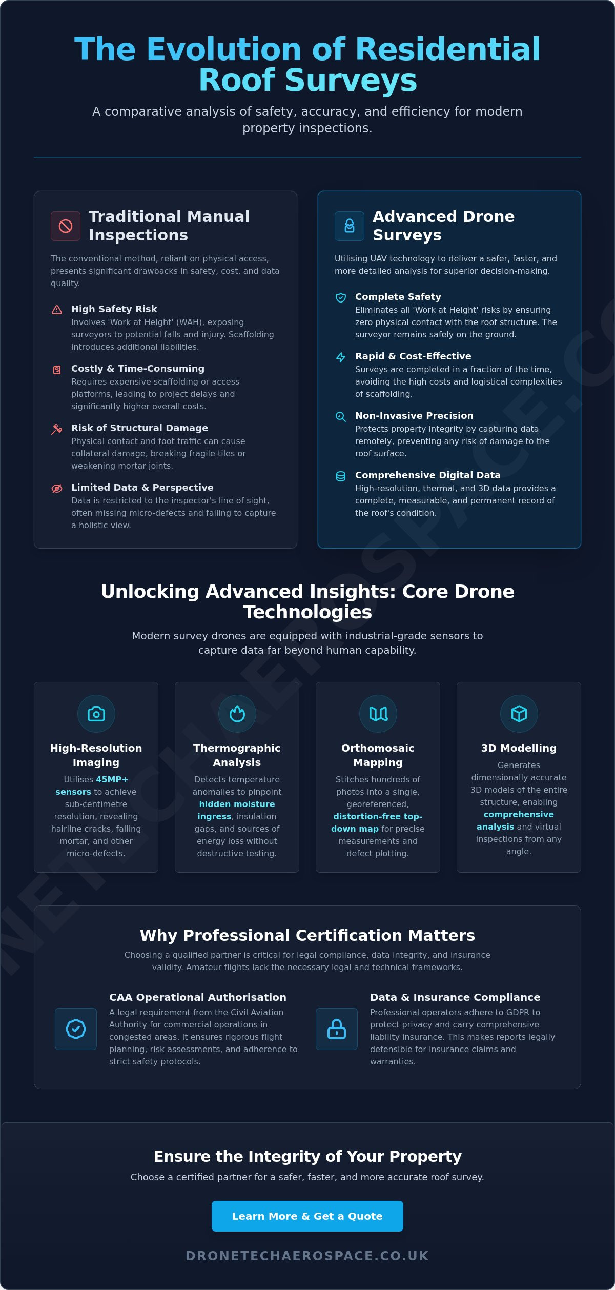
The methodology for assessing structural integrity has undergone a significant technical evolution. Traditional manual inspections, which require surveyors to physically traverse roof surfaces, are rapidly being replaced by digital aerial audits. A professional residential roof drone survey represents a sophisticated technical audit that utilises an Unmanned aerial vehicle (UAV) equipped with high-resolution sensors to capture comprehensive structural data. By 2026, the reliance on "boots on the roof" has diminished as property owners and insurers prioritise methods that offer higher precision without the inherent risks of physical contact.
Several primary drivers have accelerated this industry shift. Safety remains the paramount concern, followed closely by the requirement for cost reduction and superior data granularity. Whilst a manual inspector is limited by their line of sight and the physical stability of the structure, a UAV can access confined areas and steep pitches with absolute ease. This technological leap allows for the identification of micro-defects, such as hairline tile fractures or failing mortar joints, that are frequently overlooked during standard walk-over inspections.
The Safety Imperative in Modern Surveying
Eliminating Work at Height (WAH) risks is the most significant advantage of aerial inspections. Traditional methods often require extensive scaffolding or high-access platforms, both of which introduce significant health and safety liabilities for homeowners and contractors alike. Using remote sensing technology ensures zero physical contact with the structure. This is particularly critical when dealing with fragile roof coverings like slate or clay tiles. Manual surveyors often inadvertently cause "collateral damage" by walking on these materials, leading to new leaks or structural weaknesses that weren't present before the inspection began.
This focus on safety and structural integrity is equally important when managing redundant rooftop fixtures. For homeowners identifying obsolete equipment during a survey, Dish Goodbye provides professional removal services for old satellite dishes and aerials, ensuring that these items are safely decommissioned without risking damage to the roof surface.
Regulatory Compliance and the UK Landscape
The UK regulatory environment for drone operations is strictly governed by the Civil Aviation Authority (CAA). For any residential roof drone survey conducted in congested areas, the operator must hold a valid Operational Authorisation. This legal requirement distinguishes a professional technical survey from an amateur flight. Professional operators must also adhere to strict GDPR and data protection protocols to ensure the privacy of neighbouring properties is maintained during data collection. Choosing a partner with the correct certifications ensures that the resulting data is legally defensible for insurance claims and structural warranties. Amateur flights lack the rigorous flight planning, risk assessments, and liability insurance necessary to protect the property owner's interests in a professional capacity.
Technical Capabilities: High-Resolution Imaging, Thermal Analysis, and 3D Modelling
Modern aerial audits in 2026 rely on sensor technology that far exceeds standard consumer-grade video. A professional residential roof drone survey utilises high-megapixel sensors, often exceeding 45 megapixels, to achieve sub-centimetre resolution. This level of detail allows surveyors to identify micro-defects that remain invisible to the naked eye from ground level or even during traditional ladder-based inspections. These sophisticated payloads revolutionize building inspections by providing a level of data density that manual methods simply cannot replicate. High-performance zoom optics further enhance this capability, allowing for the safe, detailed inspection of high-risk areas like chimney stacks and ornate ridge tiles without the need for close-proximity flight.
Visual Inspection and Defect Identification
The primary advantage of visual UAV data is the ability to spot hairline cracks in lead flashing and subtle mortar degradation before they escalate into structural failures. Surveyors can also identify blocked gutters, slipped slates, and invasive vegetation growth across the entire roofscape without requiring physical access. By employing orthomosaic mapping, we generate a top-down, distortion-free view of the entire plot. This georeferenced map provides an exhaustive record of the roof condition, allowing for precise measurements of defect areas and facilitating accurate repair tenders from contractors. Property owners looking for this level of technical rigour can explore bespoke residential property drone inspections to secure their assets.
Advanced Thermal Surveys for Energy Efficiency
Integrating thermographic sensors adds a layer of intelligence that visual cameras cannot provide. These sensors detect thermal bridging and insulation gaps within the roof void, highlighting areas of significant heat loss that impact a property's energy performance certificate (EPC) rating. More importantly, thermal analysis is the most effective method for identifying water ingress points that haven't yet manifested as internal damp. Thermal drones detect moisture by identifying temperature differentials caused by the high thermal mass of trapped water compared to dry roofing materials. This proactive approach allows for targeted maintenance, preventing the widespread rot and mould growth that typically follows undetected leaks.
Accurate 3D Modelling through Photogrammetry
Utilising photogrammetry, we convert hundreds of overlapping aerial images into accurate 3D models and point clouds. These digital twins allow stakeholders to rotate, zoom, and analyse the structure from any angle on a desktop computer. This data is invaluable for heritage properties or complex architectural designs where traditional 2D drawings are insufficient for planning maintenance. The resulting 3D models provide a permanent digital record of the structure, serving as a baseline for future structural health monitoring and insurance valuations.
Comparative Analysis: Drone Surveys vs. Traditional Scaffolding
The selection between traditional access methods and aerial technology is a fundamental decision regarding operational efficiency and data integrity. Traditional "boots on the roof" inspections necessitate significant logistical preparation, often involving the hire and installation of scaffolding or high-access platforms. In contrast, a professional residential roof drone survey requires minimal mobilisation time and removes the requirement for heavy equipment on-site. This shift in methodology represents more than just a convenience; it is a transition from subjective, manual observations to objective, high-fidelity data sets.
Cost and Time Efficiency Framework
Lead times for scaffolding contractors in the UK can frequently extend to several weeks, followed by multiple days for installation and dismantling. A UAV deployment is typically organised and completed within a single day. This disparity in speed is critical during property transactions or following storm damage where rapid structural assessment is required for insurance claims. Whilst some providers offer basic aerial photography at lower price points, a professional technical survey provides a depth of data that justifies the mobilisation fee by preventing the oversight of critical structural defects. The financial savings on access equipment alone often offset the entire cost of the aerial audit, providing a superior return on investment.
Deployment: Drones are operational within minutes of arrival; scaffolding requires days of site disruption.
Access: UAVs reach chimney stacks and valleys that are often inaccessible via standard ladders.
Impact: Zero physical contact means no risk of cracking tiles or damaging historical masonry.
Data Quality and Asset Management
The disparity in data quality between manual notes and digital outputs is vast. Traditional surveys rely on a surveyor's handwritten observations and a limited number of ground-level photographs. Aerial surveys produce a comprehensive digital record, including orthomosaic maps and 3D point clouds. These digital twins allow for precise year-on-year condition monitoring, enabling property owners to track the rate of degradation in specific areas. This methodology aligns with the industrial drone inspection strategy used for large-scale asset integrity, bringing corporate-level precision to residential property management.
High-resolution visual evidence is also invaluable when negotiating with contractors. Providing a roofer with a precise, annotated photograph of a defect ensures that repair quotes are accurate and based on verified facts rather than estimates. This transparency reduces the likelihood of "scope creep" during maintenance projects. As a benchmark for high-quality aesthetic finishes following such repairs, you can discover NovoTech for premier painting and renovation services. Furthermore, the reduced risk profile of drone operations often leads to lower insurance liabilities for both the homeowner and the surveying firm, as the necessity for high-risk Work at Height (WAH) is entirely eliminated.
Evaluating Survey Outputs: What a Professional Report Should Include
The value of a professional residential roof drone survey is contained within the technical quality of its deliverables, not merely the presence of aerial photographs. A high-performance audit must distinguish itself from amateur photography by providing a structured, data-rich analysis of the structural integrity of the asset. Stakeholders should expect a comprehensive suite of outputs that allow for immediate maintenance action and long-term asset management. The documentation serves as a legally defensible record (essential for insurance loss adjusting) that details the precise state of the asset at the time of flight.
The Anatomy of a Technical Drone Report
A professional report should move beyond a simple gallery of images to provide a structured audit of every roof facet. Each identified defect must be accompanied by geolocated imagery, ensuring that specific issues (such as failing leadwork or displaced ridge tiles) are mapped to their exact coordinates on the structure. This precision is critical for tracking the progression of structural degradation over multiple years. The report must also include a comprehensive condition summary authored by a qualified professional, categorising defects by severity to assist in the prioritisation of repair budgets. For those requiring a definitive structural assessment, our Drone Building & Roof Inspections deliver this level of technical rigour as standard.
Annotated Defect Photographs: High-resolution visual evidence with clear markers indicating the type and extent of damage.
Orthomosaic Maps: A high-fidelity, top-down view of the entire roofscape, providing a distortion-free baseline for measurement.
Thermal Anomalies: Specific data points identifying moisture ingress or heat loss (if thermographic sensors were deployed).
Maintenance Roadmap: Actionable recommendations for both urgent repairs and preventative maintenance to extend the roof's lifespan.
Software and Accessibility
Modern technical surveys are delivered via cloud-based platforms that allow stakeholders to interact with large-scale data sets without specialised hardware. These platforms facilitate the viewing of high-resolution raw imagery and 3D point clouds directly within a web browser. For complex residential estates or high-value heritage properties, survey data must be compatible with Building Information Modelling (BIM) software. This integration ensures that architects, builders, and surveyors can utilise the data within their existing professional workflows. Files should be provided in industry-standard formats (such as .LAS for point clouds or .TIFF for orthomosaics) to ensure maximum utility for all technical partners involved in the property's upkeep.
The ultimate goal of the output is to provide a "single source of truth" for the building's condition. By providing precise visual evidence, property owners can secure accurate repair quotes and ensure that contractors are held accountable for the specific work identified in the audit. This transparency reduces the likelihood of unforeseen costs during the repair phase and ensures that maintenance is targeted exactly where it is needed most.
When integrating these findings into a broader property maintenance strategy, it is often beneficial to consult with established professionals; for instance, you can check out South Surveyors to help interpret technical data within the context of a comprehensive building assessment.
Selecting a Professional Partner: The Drone Tech Aerospace Advantage
The efficacy of an aerial audit is entirely dependent on the technical proficiency of the operator and the calibre of the equipment deployed. Whilst the market contains numerous hobbyist operators, a professional residential roof drone survey requires a level of industrial-grade rigour that only a specialised provider can offer. Drone Tech Aerospace positions itself as a high-capacity partner, leveraging years of experience in complex civil engineering and industrial inspections to deliver superior results for residential property portfolios. Our commitment to technical precision ensures that every data point captured is accurate, actionable, and suitable for high-stakes decision-making.
Why Industrial Expertise Matters for Residential Roofs
Applying the rigour of infrastructure surveying to domestic inspections ensures a level of detail that standard providers cannot match. We utilise the same high-specification sensors and flight methodologies employed for critical bridge and chimney audits. This transfer of industrial expertise means that even the most complex residential structures are analysed with absolute precision. Our national UK coverage allows for consistent quality across multiple sites, making us the preferred choice for estate managers and insurance adjusters who require a reliable, standardised reporting format regardless of location. Every pilot in our team holds the necessary CAA certifications and carries comprehensive liability insurance, providing property owners with total professional accountability.
Industrial-Grade Payloads: We use high-resolution and thermographic sensors designed for demanding technical environments.
Regulatory Excellence: All operations are conducted under strict CAA Operational Authorisation with rigorous risk assessments.
Bespoke Reporting: Data is processed and presented in formats tailored to the specific requirements of architects, builders, or loss adjusters.
Next Steps for Your Property Audit
Initiating a technical audit begins with a comprehensive consultation to define the specific requirements of your residential project. During this phase, we assess airspace restrictions and structural complexities to develop a bespoke flight plan. Preparing your site for a survey is a straightforward process. We recommend notifying neighbouring properties and ensuring that any vehicles or temporary obstructions are moved to provide a clear line of sight for the sensors. This preparation ensures maximum efficiency during the mobilisation phase and allows our pilots to capture the necessary data with minimal site disruption. To secure a technical baseline for your property, Contact Drone Tech Aerospace for a professional roof survey quote today.
Advancing Your Property Maintenance Strategy
The transition from subjective manual inspections to data-driven aerial audits represents a fundamental shift in residential asset management. By prioritising safety and technical precision, property owners can identify structural vulnerabilities with sub-centimetre accuracy whilst avoiding the high costs and risks associated with traditional access equipment. A professional residential roof drone survey delivers a definitive digital record that serves as a "single source of truth" for maintenance, insurance, and future structural health monitoring.
Drone Tech Aerospace brings industrial-grade expertise to the residential sector, deploying CAA-certified pilots with full Operational Authorisation. Our teams utilise high-specification thermal and 4K sensors to produce comprehensive technical reports as standard, ensuring every defect is georeferenced and actionable. This level of rigour protects the longevity of your property and provides absolute professional accountability for every inspection. It's the most reliable method to secure your investment against the elements.
Take the first step towards a zero-risk inspection process. Secure a professional technical roof survey from Drone Tech Aerospace today to ensure your property is managed with the highest level of technical expertise available in 2026.
Frequently Asked Questions
Do I need to be at home during a residential roof drone survey?
Physical presence is not required during the flight operation. Since the survey is conducted entirely from the exterior of the property, our pilots can complete the data collection without internal access. This autonomy ensures zero disruption to your daily schedule, provided the external site is clear of obstructions and any pets are kept indoors for safety during the mobilisation phase.
How much does a drone roof survey cost compared to traditional methods?
A professional residential roof drone survey is typically more cost-effective than traditional methods because it eliminates the requirement for scaffolding and high-access platform hire. Traditional inspections often incur significant "access costs" before a surveyor even reaches the roof surface. By removing these logistical overheads, the total expenditure is significantly reduced whilst providing a higher density of technical data than a manual walk-over.
Can a drone survey detect leaks that are not visible from the ground?
Yes, thermal imaging sensors can identify moisture ingress that is invisible to the naked eye or standard ground-level observation. By detecting temperature differentials between dry materials and moisture-saturated insulation, the sensors pinpoint leaks before they manifest as internal damp. This proactive identification allows for targeted repairs, preventing the widespread structural rot and mould growth that typically follows undetected water penetration.
Is it legal to fly a drone over my neighbour's property during the survey?
It is legal provided the operator holds the correct Civil Aviation Authority (CAA) certifications and adheres to privacy regulations. Professional pilots operate under specific Operational Authorisations that allow for flight in congested residential areas. We utilise strict data protection protocols to ensure that neighbouring properties are not the focus of the survey, maintaining compliance with UK GDPR and privacy laws throughout the mission.
What happens if the weather is poor on the day of the scheduled survey?
Flights are rescheduled if weather conditions, such as high winds or heavy precipitation, exceed the safety parameters of the aircraft. Professional-grade drones are resilient, but technical precision and data quality are compromised in adverse conditions. We monitor meteorological forecasts in the 48 hours preceding a survey to ensure the flight is conducted during an optimal window for high-resolution data capture.
How long does it take to receive the final inspection report?
The final inspection report is typically delivered within 48 to 72 hours of the flight completion. This duration allows for the processing of high-resolution imagery and the generation of orthomosaic maps or 3D models. The structured audit is then reviewed by a qualified professional to ensure all defect annotations and maintenance recommendations are technically accurate before the digital files are released to the client.
Is a drone survey accepted by insurance companies for roof claims?
Insurance companies increasingly accept and prefer drone-based inspection reports for claims processing and risk assessment. The high-resolution, georeferenced imagery provides an undeniable "single source of truth" regarding the roof's condition. These digital records are more robust than traditional manual notes, facilitating faster loss adjustment and providing clear evidence of damage following storm events or accidental impact.
Can drones inspect chimneys and solar panels as part of the same survey?
Chimneys, solar panels, and guttering systems are routinely inspected within a single survey flight. The versatile nature of UAV sensors allows us to capture detailed imagery of masonry, leadwork, and photovoltaic cells simultaneously. This comprehensive approach ensures that all rooftop assets are audited for structural integrity and operational efficiency without the requirement for multiple site visits or separate access arrangements.


Comments